
IN FOCUS: The fight against Jakarta’s devastating yearly floods

Source: CNA
Date: February 6, 2021 (Updated: May 4, 2021)
The Indonesian government is exploring multiple options to contain the worsening floods, but there are obstacles including climate change and illegal settlements.
JAKARTA: As thunderous clouds roll in from the sea, Jakarta residents brace themselves for a familiar scenario.
Heavy showers soon drench parts of the city and in just a few hours, rainwater begins to overwhelm the drainage system.
When that happens, major streets, roads and back alleys are inundated in ankle-deep, sometimes knee-deep water, causing traffic gridlocks so severe that motorists find themselves stuck on the roads for hours.
But there is more trouble to come. The clouds begin to move to the mountainous suburbs further south. As massive rainfall hits these upstream areas, creeks and rivers begin to swell and the dozens of flood control dams and sluice gates along their paths start to raise their alert level.
It won't be long before the dams are overwhelmed and officials manning them are left with no choice but to release the water. A flood is imminent and the surging water is on its way to the capital city.
Residents who live near the rivers are immediately notified. Like clockwork, they begin to move their precious belongings to safer places.
There are those who choose to abandon their homes entirely and seek refuge elsewhere. Others prefer to stay behind and protect their properties by keeping the water at bay.
No one can tell whether the flood will be severe. And sometimes people underestimate the extent of the incoming flood, resulting in devastating consequences.
Each year, dozens of people are killed and thousands of houses across Jakarta are flooded in murky brown water up to 3m deep.
On Jan 24, hundreds of people were affected when floods inundated several major streets and housing complexes across Jakarta and neighbouring Bekasi after heavy showers swept across the two cities.
But the floods were nothing compared to the devastation caused by a massive flood in January last year, which killed 66 people and forced 170,000 people to seek shelter in Jakarta and its surrounding suburbs.
On average, a flood results in around US$532 million of property and infrastructure damage in the metropolitan area, according to estimates by the National Development Planning Agency.
Flooding has affected Jakarta for centuries, all the way back to when the city was the capital of the Dutch East Indies and went by the name Batavia.
As the population grew exponentially and Jakarta became a vast metropolis, the problem became so severe and complex that mitigating the floods requires three provinces, multiple levels of governments and various agencies to work together. Occasionally, there is a lack of consensus on how to proceed.
There are multiple root causes, including deforestation, poor drainage, narrowing rivers and land subsidence. The authorities are exploring various options such as a giant sea wall, more dams and other technical solutions.
"Jakarta residents really only have two expectations for their government: A traffic-free Jakarta and a flood-free Jakarta," city planning expert Nirwono Joga told CNA.
But these expectations are by no means easy to meet. After decades and billions of dollars later, the goal of a flood-free Jakarta continues to be elusive.
With climate change bringing more extreme and unpredictable weather patterns, flooding is expected to worsen if nothing is done.
UPSTREAM: MASSIVE LAND CONVERSION
The problem begins 50km south of the city, at the foothills of Mount Pangrango, a dormant volcano towering 3,000m above sea level. Natural springs and rainwater falling on its slopes eventually form major rivers that flow into Jakarta.
Lush green forests at the foot of the mountain have been cut down, replaced by housing complexes, posh villas, tourist resorts, high-rise hotels and chic restaurants.
These man-made structures have reduced the soil's capacity to absorb the torrential rains and thunderstorms which frequently hit the area during the rainy season.

"The water appears to be flowing faster and faster," said Mr Abdul Lutfi, a resident of Megamendung district which straddles the Ciliwung River, the biggest and most flood-prone waterway to flow into Jakarta.
In some parts of Megamendung, the river sits on a deep ravine eight meters tall. On a summer day, the water is shallow and clear, moving sluggishly down the stream.
But during the rainy season, it is not uncommon to see the river raging with water level surging by 4m, bringing with it mud and debris which turn the water brown, said Mr Lutfi. Sometimes the river current is so strong that there are landslides.
According to government data, the upstream regency of Bogor has lost 1,200sqkm of forests in the last 40 years while the number of dwellings increased 6,400 per cent. Forested areas now represent just 26 per cent of Bogor's 2,664sqkm area. In 1980, the figure was 74.8 per cent.
As a result, water runoff increased from 15 per cent to around 70 per cent.
"There is environmental degradation in Bogor. Water catchment capacity has reduced significantly. We can see this through the increase of water flowing to rivers," said Mr Joga, the city planning expert.
Meanwhile, torrential rains are happening more frequently and are of greater intensity, a consequence of the changing climate.
According to the Indonesian Meteorology, Climatology and Geophysics Agency (BMKG), daily rain intensity in Jakarta and the surrounding areas have been increasing each year by between 1mm to 2mm. The 377mm rainfall in one day that caused the devastating floods at the beginning of 2020 was the biggest in Jakarta's recorded history.

There have been efforts to tear down the villas and reforest the upstream areas, Mr Joga noted, particularly after Jakarta began seeing bigger floods.
"But the enforcement has not been maximum, because some of the villas belong to important people living in Jakarta. The enforcement has been selective, based on who owns the villas," he said.
"Villas, housing complexes and tourist areas continue to be built because that is the main source of income for the local government."
DOWNSTREAM: "DRAINAGE SYSTEM CAN NO LONGER COPE"
The land conversion continues as the rivers make their way north. Along the way, riverfront villas and golf courses are replaced by modest houses and factories before the rivers enter Jakarta where high-rise apartments, office buildings and shopping malls compete for space with low-income neighbourhoods.
As Jakarta's population grew, watersheds, marshlands and low-lying basins were converted into settlements.
"Jakarta has areas called Rawa Buaya, Rawa Badak, Rawa Bambu and so on," noted Mr Firdaus Ali, a water management expert and environmental engineering lecturer at University of Indonesia. "Rawa" means marshlands in Indonesian.
"We used to let water inundate these areas because they served as buffers to contain excess water. But because we needed space, we converted them into commercial and residential areas."

These former marshlands are flood-prone and Ms Yati Saimah, a resident of Rawamangun in East Jakarta knows this first hand.
"I have lived here for 40 years and the flood was never this bad," she told CNA of a flood that happened on Feb 25 last year. "Water inundated my neighbourhood up to my waist. Before it only went as deep as my knee."
Rawamangun is 1km from the nearest waterway, the Cipinang River. Flooding here is not caused by river overflow but torrential rain. On Feb 25, heavy rain pelted the area for more than 12 hours.
The water did not completely recede until 12 hours later, the 45-year-old recounted.
Among the reasons for the flood water taking a longer time to recede is drainage issues in the city. During major floods in Jakarta, some areas have been inundated for days.
According to Mr Ali, the water management expert, only 40 per cent of Jakarta's 1,553km sewers and drainage pipes are functioning properly.
"There are sewers which are clogged by trash and sediment, deformed, not connected to bigger drainage pipes, encroached by locals who built houses and shops over it. The city's drainage system is paralysed and water cannot drain quickly," he said.

To make matters worse, the city's drainage system was designed to cope with 150mm of rain per day, which is inadequate during the rainy season when there could be more than 300mm of rain daily.
"Our drainage system can no longer cope with the amount of rainfall we are seeing, which is expected to increase as a result of climate change," city planning expert Mr Joga said.
Mr Joga estimated that only 33 per cent of Jakarta's drainage system is working properly.
Jakarta's drainage system is so bad it is not uncommon to see flooding on major streets where multi-national corporations, international agencies and government ministries are headquartered.
"Ninety per cent of Jakarta is paved in concrete and asphalt, so the ground has little capacity to absorb water. Most buildings are not equipped with vertical drainage. Every time it rains, water is running off the buildings, overwhelming our already overwhelmed drainage system," Mr Joga said.
There are plans to mandate buildings in Jakarta to have 30 per cent of their area converted into open green spaces and for the buildings to have zero water runoff during the rainy season.
"But enforcement has been weak," he said.
NARROWING RIVERS AND DRAINAGE BASINS
There are 13 rivers flowing into Jakarta, from meandering waterways which have existed for centuries to man-made canals meant to divert water away from the Indonesian capital. All are considered flood-prone.
By law, no one is supposed to build houses within 50m from the water's edge. But due to lack of enforcement, illegal dwellings are sprawled along the riverbanks.
"The rivers have narrowed. In the 1970s, they were 50m wide. But now they can be as narrow as 15 to 20m," Mr Joga said.

Today, Jakarta's 13 rivers are capable of containing 950 cubic metres of water per second. However, during the rainy season, the flow of water running through these rivers can surge to 2,500 cubic metres every second.
Sometimes, the flood got so bad entire neighbourhoods were submerged in murky brown water 3m deep. It is hard to distinguish where the river ends and land begins, except for the rows upon rows of rooftops jutting out of the water.
And it is not just rivers that are narrowing. Along the rivers, there are 208 man-made retention basins, built to contain water runoff and prevent flooding. Many of these flood basins have been completely occupied by illegal settlements and sometimes large property developers.

In one retention basin, the capacity has drastically reduced from 8 million cubic metres to just 1 million cubic metres in 40 years because of illegal squatters. The occupiers often treat the basin as their waste dumping ground. Their presence also prevented heavy machinery from dredging decades of sedimentation.
The government is trying to reclaim these retention basins and clear up land needed to widen the rivers, but these efforts are often met with resistance, legal challenges and street protests.
"We have spent a lot of time in courts, time which could have been spent building infrastructure or doing something else," Mr Bambang Heri Mulyono of the Indonesian Ministry for Public Works told CNA.
Mr Mulyono, who is in charge of infrastructure work along the 119km Ciliwung River, said there are stretches totalling 17km in length which are not protected by dikes and retention walls.
"When the flood comes, water will inundate these areas and from there, water will spread everywhere," he said.

The plan is to widen the river by 7.5m on either side and relocate people who have been occupying the riverbank illegally for generations elsewhere. Some neighbourhoods have been cooperative but others have not.
"This is the main reason why the flood mitigation programme has been slow. We have to deal with these problems," he said.
SINKING COASTAL AREAS
By the time the rivers reach coastal areas in the north, the water flow is low and unable to discharge into the sea.
Instead, trash-filled and foul-smelling water has to go through large pumping stations at the mouths of the rivers, which can lie between 1m and 4m below sea level.
"The rivers are already lower than sea level because of land subsidence. That's why water from these rivers have to be pumped out. During a flood, water can accumulate very quickly and the pumps need a much longer period of time to get the water out," Mr Peter Letrite of the Dutch water management consultancy Deltares told CNA.
Jakarta, which lies on loose and unconsolidated soil and sediment, is one of the fastest sinking megacities in the world with land subsiding at a rate of up to 26cm per year in the softer, sandy soils of the north and 1cm per year in the firmer soils of the south.

Land subsidence can occur naturally through tectonic quakes or following man-made activities such as construction and groundwater extraction.
"We don't have reliable freshwater supply. Today, our piped water system serves less than 47 per cent of Jakartans. Meanwhile, the need for freshwater increases as we build office buildings, malls, hotels and apartments. As a result, they (residents) performed excessive groundwater extraction which prompted land to subside,"Mr Ali, the water management expert, explained.
According to findings from the Bandung Institute of Technology (ITB), 90 per cent of Jakarta's coastal areas now sits below the surface of the sea.
These communities are protected from becoming fully submerged by elevated concrete dikes and breakwaters in upscale seafront housing complexes and apartments.
For those in middle-income neighbourhoods, there are retainer walls barely 1m thick supported by sloping buttresses. Impoverished fishing villages can only rely on sandbags for protection.
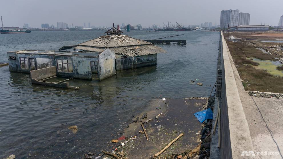
But water sometimes breaches these defences, turning industrial estates and fishing neighbourhoods into uninhabitable swamps.
As land subsidence continues, these walls and embankments are also sinking and have to be raised by 20cm to 30 cm each year.
Occasionally, strong winds and high waves would hit Jakarta's 46km coastline and the sea would surge so much the walls are unable to contain it. Breeches and overtopping occur and seawater would flood communities up to 3km inland.
And when these storm surges happen at the same time as the fluvial floods, the result can be catastrophic.
In February 2007, Jakarta was besieged by coastal flooding from the north and river flooding from the south, causing 60 per cent of the city to be inundated. In some areas, water did not recede for ten days. Seventy thousand homes were flooded and 80 people were killed that year.
Mr Heri Andreas, a Bandung Institute of Technology expert on geodesy, which studies how the earth's geometric shape changes over time, told CNA that the 2007 flood would not have been as severe had there been no land subsidence.
In early 2020, the scientist created a computer simulation on what would happen to Jakarta if land subsidence had been stopped completely in the last 40 years. In that scenario, floodwater would wash out to sea unimpeded.
"Land subsidence has increased the number of flood-prone areas by 300 per cent. Had we stopped groundwater extraction in the 1980s, flood-prone areas would be a third (of what they are now), even as rainfall and our retention capacity remains the same," Mr Andreas said.
To make matters worse, land subsidence also occurred in the interior parts of the city, as far away as 20km from the coastline. Although not as severe as the coastal areas, land subsidence has caused many areas to sit lower than the rivers, increasing the amount of flood prone areas across Jakarta.

Mr Andreas's research has also shown that 40 per cent of Jakarta could be below sea level by 2050, including much of the city's business districts. "We need to pay attention to these topographical dynamics. Right now, our flood mitigation policies and plans do not account for land subsidence," he said.
GIANT SEAWALL CONTROVERSY
To combat the floods and mitigate the irreversible effect of Jakarta's land subsidence problem, the government in 2013 proposed the building of a giant sea wall stretching more than 30km across the Jakarta bay area.
In the initial plan, the giant dike, which doubles as a toll road, would convert 148sqkm of sea into two freshwater lakes filled with man-made islands. From the air, it would resemble the mythical bird Garuda, Indonesia's national symbol.
It promised to be a panacea to Jakarta's problems of land subsidence, rising sea level, annual flood and freshwater shortage.
But scientists and activists believed that the plan was only good on paper and would most likely cause an ecological disaster.
Mr Muslim Muin, a hydrodynamics expert from Bandung Institute of Technology, said the rivers which flow through Jakarta are silky and brown, filled with trash, silt, sediment and toxic industrial wastes, making the plan to convert the sea into a freshwater reservoir infeasible.
"We will not be able to use the water as our freshwater source because there is too much pollution. We will end up spending more money each year to treat the water, dredge the sediment and pump excess water out to sea during the rainy season," Mr Muin told CNA.
During the dry season, when there is not enough water flowing from the rivers, the whole area will not function as a reservoir, but a trash-clogged evaporation pond, he predicted.
Jakarta's rivers are so polluted that today, 80 per cent of the city's piped water is sourced from a reservoir 48km east.

The giant seawall, known formally as the National Capital Integrated Coastal Development (NCICD) project, also has a lofty price tag of US$40 billion, nearly seven times the city's annual budget as a whole.
To help finance the dike, the government turned to property developers who were promised permits to build artificial islands.
"It was assumed that the NCICD plan would have to be paid by Jakarta, not by the national coffers. Because the Indonesian government said they have (to deal with) so many issues in other cities. The only way to finance this is through land development," said Mr Letrite. Deltares, his consultancy, was tasked with studying the plan.
"The price tag became big because all sorts of things were put into the NCICD project like the improvement of water treatment, improvement of water supply. With new land, you need more roads, more infrastructure and so on."
The islands would be occupied by upscale waterfront properties where the rich can dock their yachts.
"This meant that only the rich would have access to the sea and not the tens of thousands of fishermen whose livelihoods depend on it," said Mr Abdul Halim of the People's Coalition for Fisheries Justice.
The giant seawall, and the freshwater it would have created, would also spell the end of Jakarta's last remaining mangrove forests in the north-western part of the city. The mangroves, which need brackish water to survive, are home to a wide variety of wildlife.
The Jakarta government issued a permit to two property developers and state-owned port company, Pelindo in 2016 to build four artificial islands, even as the seawall project was hamstrung by controversies and eventually put on the backburner.
Building the artificial islands creates another ecological problem, Mr Muin said. "They will obstruct the flow of the rivers. Water will slow down and form sedimentation and if the sediment is not dredged regularly, it will worsen the floods further upstream," he said.
City planning expert Mr Joga said the giant wall does not address the underlying problems.

"We still need to address the environmental degradation in the upstream areas, widen the rivers, increase the capacity of our retention basins and ponds, fix Jakarta's drainage system and add more open green spaces where rainwater is absorbed," he said.
"Those steps will already reduce the floods significantly."
With much criticism towards the project, including from the current city governor Anies Baswedan, the central government has to go back to the drawing board.
"The latest plan is to construct an open coastal dike which reduces the impact of the waves, but still leaves the ports open, mangroves will continue to grow, fishermen can still use these fishing grounds and it will not have such drastic social and environmental impact (as before)," Mr Letrite said. "That is now the concept. It will be a much cheaper solution."
But even the new plan, which is still being finalised, does not please all stakeholders. "Not all (political) parties agree on the design. Not all parties agree on how it should be financed. That is complicating the decision making," he said.

PUBLIC WORKS MINISTRY HAS MORE TECHNICAL SOLUTIONS IN THE PIPELINE
With the giant wall project seemingly on the back burner, the government is working on various infrastructure projects which officials say will alleviate the flooding situation.
The public works ministry is currently constructing two dry dams in the upstream areas of Ciliwung River, said Mr Mulyono.
During the wet season, the Ciliwung can send 365 cubic metres of water every second to the lowlands and the dams will reduce this to 253 cubic metres every second.
The two dams: the Ciawi and Sukamahi dry dams, will have a combined capacity of 7.6 million cubic metres which means it can cut down water influx in the flood-prone river for up to 19 hours.
"We can keep cutting down the water flow until the water level recedes and return to normal. Once water level recedes, we can release the water back to the river," Mr Mulyono said.
The ministry hopes the two dams will be ready before the next rainy season begins in late 2021.
By the time the Ciliwung enters Jakarta, the river will have had more water coming in from the hundreds of tributaries along its course and the flow of water will have risen to 570 cubic metres per second.
The government is planning to build dikes along stretches of the Ciliwung totalling 17km in length. These stretches are now unprotected and illegally occupied by settlers.
There is also a plan to build an underground pipe to channel some of the Ciliwung's excess water to the 23km long East Flood Canal, which is currently used to divert water from the Cipinang, Sunter and Buaran rivers to the sea
"The length of this tunnel is 1.2km. We have built 600m from the outlet and we need 600m more. But the planned inlet is still occupied by settlers, so we cannot do our work," he said.
For the other 12 rivers, the ministry is focusing on restoring the capacity of 208 retention basins and ponds along their courses. Again, there are issues with land availability and the presence of illegal settlements.

The government has been trying to relocate settlers along the Ciliwung River since 2013.
It also took the government years to secure the land needed for the Ciawi and Sukamahi dry dams before construction finally started in 2016.
Relocating settlers is a painstaking process involving rounds of negotiations. It is also politically sensitive, so unpopular in fact that it became a sticking point during the 2017 Jakarta election which saw the defeat of the incumbent Basuki Tjahaja Purnama, a proponent of the relocation programme.
During the election, Mr Baswedan had promised voters he would not pursue the same policy as his predecessor.
"Relocation will only cause miseries for the people. Therefore, I am committed not to perform any relocation," Mr Baswedan told his supporters in March 2017, during a campaign rally in North Jakarta.
The governor reiterated his commitment after he was sworn in during a visit to West Jakarta in November that year. "I don't like to relocate people. We will organise (the neighbourhoods) instead. These are people, not objects," he told residents.

"WE HAVE DONE A LOT", SAYS JAKARTA'S WATER RESOURCE AGENCY
Ms Baswedan has been working with a shrinking budget for flood mitigation.
Before he was sworn in, Jakarta's budget for flood mitigation was US$221 million, which included numerous land purchase and relocation projects. In 2020, the budget fell to US$105 million and land clearing was halted.
"This is why Jakarta's flood mitigation programme seems to be going nowhere," water management expert Mr Ali said. "Whoever the governor is, people need to be relocated so the rivers can be widened, whether he likes it or not."
There are signs that Mr Baswedan might have changed his mind about the relocation issue. Chief of Jakarta's Water Resource Agency Juani Yusuf told CNA that the city has earmarked US$355 million for this year's flood mitigation programme, the majority of which will be used to purchase land and relocate settlers occupying rivers and retention basins.
The pivot came months after a massive flood in January 2020. It was the worst flood to occur during Mr Baswedan's administration and one which caused several people to sue the city.
Mr Yusuf pointed out that the governor has never said that there will be no relocation during his administration.
"We are avoiding relocation whenever we can but he never promised that there would be zero relocation. As long as it is for the good of many, we do (it)," he said.
Mr Yusuf said his agency has been focusing on deepening rivers and basins as well as building vertical drainage that do not require land acquisition and relocation.

"We have done a lot actually. So, it is not true that Jakarta's flood mitigation efforts have stagnated," he said.
"This year, the governor has instructed us to increase the capacity of five rivers. We aim to work with the ministry and finish the widening of the Ciliwung River," he said, adding that his office will focus on lands where residents have agreed to be relocated.
"There are lands which we have negotiated but their acquisitions stalled because of budgeting issues, including the lands needed to make the underground tunnel connecting Ciliwung and Cipinang rivers. We will prioritise those lands first."
Despite these efforts, experts are far from convinced.
Mr Joga said Jakarta has the potential to be on par with other great cities of the world. "But Jakarta cannot maximise its potential because of bad management. (Jakarta) has the potential. It has money. And yet here we are, dealing with flood issues year after year," he said.